Take a Hike
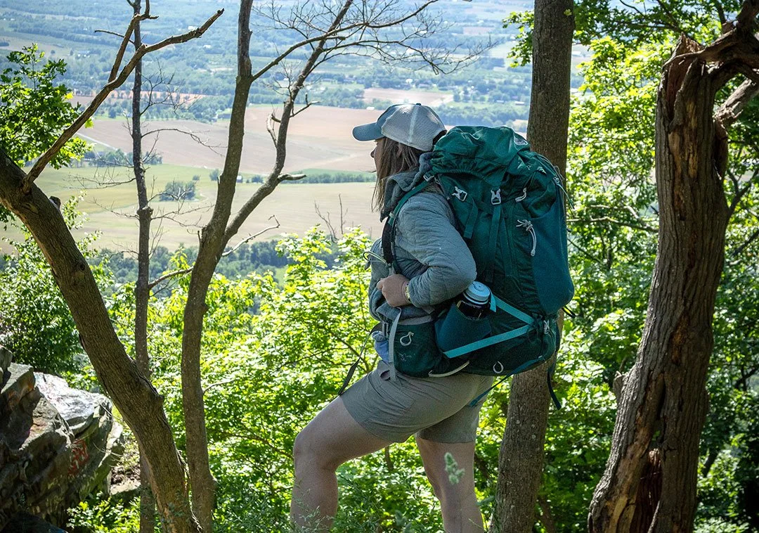
The author ponders the view from the Appalachian Trail near High Rock.
Maryland’s stretch of the Appalachian Trail runs along the crest of South Mountain, and almost all of it is in Washington County
By Laura Forrest Hopfauf / Photography by Mark Youngblood
I’ve reached that stage in my life when I say, “I used to” a lot. I used to be able to run a marathon. I used to drink a few beers and get myself into trouble. I used to hike.
I used to hike quite a lot. I have done most of the Appalachian Trail in Maryland and West Virginia, some in Virginia, Pennsylvania, and Tennessee, too. I have hiked across rugged untamed wilderness of the lesser-known Caribbean island of Dominica, to the bottom of the Grand Canyon, to the highest point in Texas and through the backcountry of the vast, high-altitude and very isolated Chihuahuan Desert.
Maybe I was more comfortable on a hike than I was in everyday life. But I have spent the past six years pregnant or nursing, and after turning my body into a bed and breakfast, I’m not quite what I used to be. I needed to get back “out there,” and with the Appalachian Trail, my first and still favored trail, running right through the county where I grew up and now live, I made time to hike the entire 40.9-miles to see what I might find, who I might meet, how I might reconnect with my past.
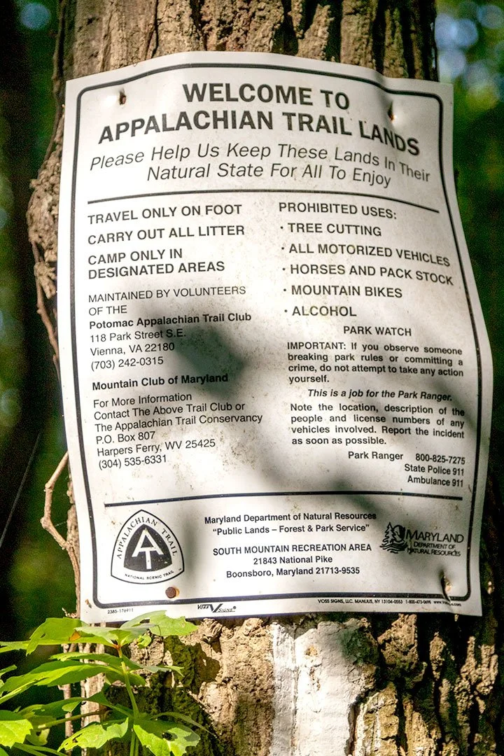
The AT runs 2,197.9 miles (although this distance is often argued between government agencies and other people with too much time on their hands) along spines, ridges, crests and peaks of the ancient Appalachian Mountains through 14 states from Georgia to Maine. The AT isn’t the longest trail in the nation anymore, but it’s still the first. From its formal completion in 1937 the trail has been the pioneer and trend-setter for all the trails that followed in our country and many others. Today the trail is cared for by the Appalachian Trail Conservancy, state agencies like the Maryland Department of Natural Resources, the National Park Service and private citizens who volunteer by the thousands every single year.
And it’s free. There’s nowhere on the AT that charges you to hike, to take a picture on an outcropping, to walk under a natural arch or stumble upon a stream. It’s an astounding and beautiful tradition in a country and point in history where commerce is king.
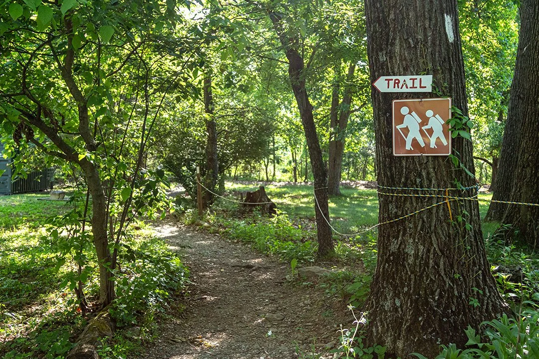
Trail signs keep hikers on course.
The majority of Maryland’s brief portion of the AT reside in Washington County, so I thought if I hustled and could get four good days, I could hike the whole thing in less than a month. This was ambitious. I hadn’t hiked seriously since I had gotten pregnant with my first born in 2020. I was planning to eat like a fifth grader while I was on the trail. I was going to wear sneakers with a hole cut in the side to let my broken toe (courtesy of a cooking accident with two falling plates that showed no mercy) hang out like a flag so it wouldn’t get pinched and sing in pain.
By 6:30 the first morning of my quest to finish Maryland in a month, I parked at the lot on U.S. Route 40, right outside of Boonsboro and headed south.
In the beginning of my hike all I felt was wonder. It had been so long since I had been alone in the woods, a thing that has always been a balm to my soul, that I spent the morning soaring. As much as I could forget about a broken toe, I did. I passed a hillside of ferns below the trees that covered the ground as far as I could see, so many tiny leaves all stretching to the sun. Their collective body a shade and texture of green I’d want to capture but never could. The sunrise split the trees, streaking light though the forest in a hundred different lines, casting the trail in a golden hue as if it were out of a fairy tale.
In a little over an hour I made it the three miles to Washington’s Monument. On the way there I passed another solo hiker loaded with a real pack who kept his head down as he said hi. It was nice. Not to be needed. Not to be required to have a conversation. To be able to pass someone doing the same thing as me going in the opposite direction, exchange a hello and speed onward.
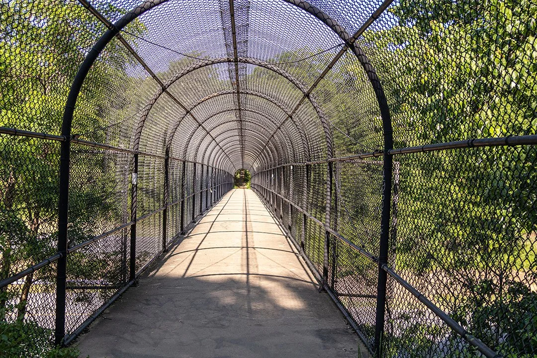
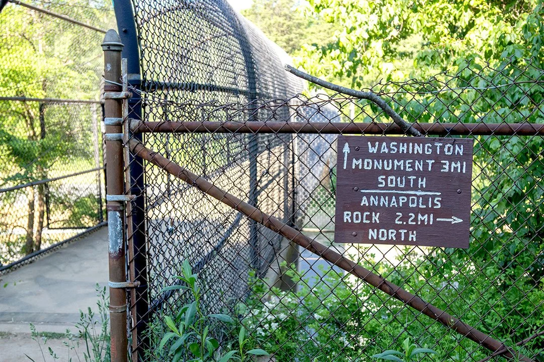
A caged, concrete bridge carries the trail over Interstate 70.
Going south from U.S. 40 there are landmarks that break the trail for the next 10 miles. If you’re goal oriented like me, it can be a real morale booster. Every couple of miles there’s something to cross off the list: Washington’s Monument, Turner’s Gap, Dahlgren Backpack Campground, Reno Monument, Rocky Run Shelters, Lambs Knoll, White Rock Cliff.
In five hours, I made it to White Rock, an outcropping a literal 10 steps to the side of the trail with a mosaic view of alternating dark forest and light farm green that ran until the horizon. I talked to a group of hikers who were resting there when I showed up. They were a small group from Pennsylvania who were section hiking a portion of Maryland’s AT for the weekend.
The man in the group made it a point to say I was only in-and-out hiking (where you don’t stay the night on the trail and are thus not required to lug around a pack the size and weight of a suitcase you might take to the airport). He sized me up in a way that was obviously judgmental. Taking in my sneakers with my neon pink painted toe hanging out the side. Watching me stab a straw into my pilfered juice box and start on my gummy bears. Glaring at my very small pack with a pair of very large scissors in case my sneaker needed further dismantling to accommodate my toe but no other obvious supplies. He quizzed me like I should know the name of every shelter in my home state. I had flashbacks to high school when I could never get the chronological order of any historical event straight. They left while I was finishing up my gummy bears. When I turned around, since I was only a measly day hiker and needed to meet my family for a ride home for lunch, I passed him sitting down, looking tired, less than a mile from where I had last seen him.
I’d like to tell you that I didn’t take some glee in that. But it turns out the woods can only fix so much of a person’s shortcomings.
On the way home, my daughters quizzed me about the bears and wolves I must have seen deep in the woods. There’s a lot that people don’t tell you about the woods, and what they do tell you is often the scariest and most exaggerated version. So, I’ll dispel some of those theories while stating a few lesser-known facts about the AT in Maryland.
1. The trail is not full of rattlesnakes, despite how many people claim to see them. It is not an Indiana Jones movie out there.
2. There are bears—though I’ve never seen one hiking the AT. They aren’t seeking out people like a traveling salesman with a trunk full of Encyclopedia Brittanica’s in the ‘70s.
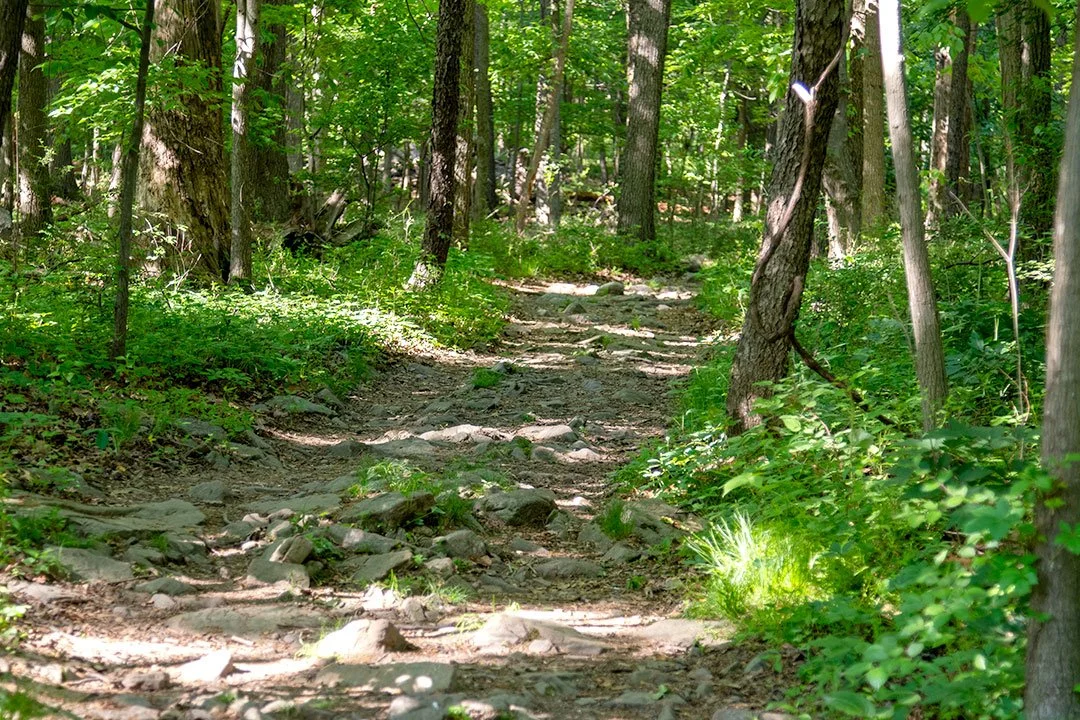
3. It’s rocky. There’s portions where it’s all rocks that feel like they are personally trying to attack you. They stab the bottom of your feet; they shift; they trip you. It feels like walking over giant Legos.
4. There are lots of places to stop and see. It’s almost like an interstate with exits—overlooks, campgrounds, springs, roads. This makes the trail accessible in a way that other states that are part of the AT just aren’t. That’s probably part of the reason thru-hikers consider Maryland a walk in the park.
5. It is not full of serial killers. Or people out to hurt you. If you hear rustling, it’s most likely just a chipmunk.
Overall, it’s safe. I’m not saying as a solo woman hiker I never jump out of my skin—but that’s from too many horror movies in my youth. On the AT in Maryland, there’s nothing resembling “Deliverance.”
Mostly the 40 miles of the AT in Maryland stay in Washington County, though the path tracks into Frederick County as well. Throughout the state, the trail crosses three Maryland State Parks that count their daily visitors—South Mountain, Washington Monument and Gapland. In a year the total visitors to those three parks alone sits at nearly 300,000 people. It’s hard to say exactly how many of the visitors step onto the AT. But even if we conservatively only say a third, that’s 100,000 people.
An economic impact study commissioned by the Hagerstown/Washington County Convention and Visitors Bureau (CVB) found the average visitor in Washington County spends $265 a day during their stay in the county.
I’m not trying to blow anyone away with math here, but 100,000 people times $265 is a cool $26 million. Even if you think this math is total hokum, a sizable portion of that money most likely does end up in Washington County. Even just an eighth of that is a little over $3 million. That’s a lot of money for a free trail to bring into our county.
When I speak to Daniel Spedden, president of Hagerstown/Washington County CVB, he tells me something that I find profound. “The main reason people visit Washington County is for state and national parks. And the number one activity is recreational trail use. The AT is an iconic landmark that gives us worldwide exposure as a destination.”
Pretty amazing for a trail that a decently unorganized group of people finished in 1937 and mostly a community of volunteers has maintained for nearly the past 100 years.
I set out from U.S. 40 again a little over a week after my last hike after a solid five days of rain that just wouldn’t stop. There were maybe two other cars in the lot. I hiked north this time. In my head I wanted to get 10 miles, but I was ruled by the clock because I needed to be home by noon. So, I left my distance to fate.
On the two-mile hike to Annapolis Rock, I passed camps but didn’t see anyone until I got to the overlook. A group of college-aged boys sat on the edge eating what smelled like pancakes while blaring indie rock. The first thing I heard one of them say was, “As soon as we get out, I’ll send it straight to the story, bro.”
I wanted to laugh but I’d watched enough true crime to know I shouldn’t just assume that the boys who seem like bros on the rock are just bros on the rock (It’s easy to tell you there are no serial killers, but it’s hard to believe it when I’m alone on the trail). So, I didn’t make a peep. I headed to another portion of the overlook hidden by some trees.
There wasn’t much to see if you were looking for the actual view. The fog, clouds and rain covered the overlook in pillows of grey. I couldn’t pick out a single thing on the horizon. I couldn’t even see the horizon. On top of my section of rock, I watched the mist rise and fall, drift and converge as if it were dancing in worship of the day it’d been given in the valley while I ate my clementine.
I came and left without the boys ever noticing that they had company. And I think that’s nice, not just because it kept me from getting murdered. I’ve had times when I was the only one at an overlook with someone I loved. Those precious moments let me feel like I was an actual explorer seeing something no one had seen before. So, I gave them that gift for free, even if they were going to post it on all their socials as soon as they got service, returning to the trail unseen with their indie rock fading behind my back.
Over the next two miles I passed a few people. But for the five miles after that, shortly after I crossed over Black Rock Creek that had flooded the trail and left me skipping rock to rock to keep my toe semi-dry, I saw no one. I was alone.
In the rain and light breeze, the spring ground cover, lush and green, stood about a foot tall and waved like the ocean. I stopped and watched the ferns move like the tide going in and out. The vegetation shifting in one big motion from moment to moment like it was lying on the chest of a giant taking deep breaths. The sound was consuming in its utter lack of sound. There were the raindrops. There were the birds. There were my shoes, swishing and slashing over the mud. Once in a while there was a hum of a plane overhead that I couldn’t see through the canopy of trees or a rumble of a road in the distance that I couldn’t see through the fog.
Even in that little bit of time, just a morning in the woods, when I hit Wolfsville Road where my family was coming to pick me up, the cars seemed faster than usual—like I was watching a race rather than people out on a drive to get groceries.
I immediately disappointed my daughters again with my lack of bear sightings. I was slightly redeemed when I told them I heard an owl, only to be crushed again when I had to admit I didn’t see it.
I’d finished nine miles before lunch. I was almost halfway through Maryland. I spent the drive back home trying to figure out ways I could finish the remaining half before the month was out.
Maryland is close to the geographical center of the AT (Harper’s Ferry, West Virginia, is generally considered the mid-way point even if that isn’t 100 percent accurate). If a thru-hiker is going north from Georgia, they feel like they’ve made it to the Northeast when they step boot Maryland. If they’re going south from Maine, they feel like they’ve made it to the South when they cross the Mason-Dixon. It’s the crux of the Middle Atlantic. And it’s the point that most thru-hikers start to feel like they might actually finish the whole thing.
Scott Fales, an avid hiker from Sharpsburg, acts as a trail angel for the AT. Trail angels are just people—some hikers, some not—who help upkeep the trail, support hikers, offer rides to town and back, leave snacks or drinks along the trail for hikers to grab as a treat on the way. Fales and his wife, Kathy, help thru-hikers as they come through the area. They’ll start supporting a hiker when they have 50 miles left in Virginia and follow them through Maryland until they are about 50 miles into Pennsylvania. Scott will hike with them and has hiked a large portion of the AT himself.
“This trail is truly special,” Fales tells me. “It’s a special place. There’s great folks on the trail.”
In 1968 on July 4th, Fales was 10 years old hiking with his dad on the AT from Gapland to Reno Monument State Park. By chance they happened to cross paths with Elmer Onstott. Onstott was a 69-year-old inexperienced hiker from Missouri who set out to thru-hike the AT. He managed to do 1,999 miles of it before he was stopped just short by snow that had made his final stretch of Maine impassable.
President Lyndon B. Johnson famously asked Onstott to come to the White House on his way from Georgia to Maine to attend the signing of the National Trails System Act, legislation meant to establish and protect hiking trails across the county. Onstott refused to come off the AT even for the President of the United States.
That happenstance encounter made an impression on a young Fales that fed his love for the AT that’s lasted his entire life.
I fell in love with the trail young, too. My dad was a former Green Beret who taught me how to hike before I started kindergarten while my mom walked her dog every single day on the C&O Canal. Between the two of them, walking in the woods became a habit that, like Fales, I turned to when I needed to feel anything.
Despite my best intentions, I didn’t make it out for my final jaunt in the woods for another week because my life is currently sandwiched between soccer practice, naps, pool parties, mountains of dishes and piles of dirty laundry. I like it this way, truly. But it makes it hard to find time to wander around in the woods.
At 5 p.m. I started from High Rock, a rock outcropping near Smithsburg that’s been graffitied and has a parking lot next to it with an easy few stairs to the view (I’ll let you guess how people were feeling when they graffitied it based on the name). But I didn’t go to see the overlook at High Rock. I didn’t even stop to look at it before I took off for the trail. I wanted to hike to Raven Rock, what I considered in my infinite knowledge a superior view. I was in hurry because I didn’t have much light or time left in the day. I hiked quickly. I didn’t stop to eat the granola bars or sausage sticks I stole from my kids snack packs.
Fifty minutes in I thought it was strange that I hadn’t passed more people coming back from the overlook. I hadn’t passed anyone since I had left the spur trail for High Rock and entered back onto the actual AT. I knew something was off. So, I did something I hardly ever do when hiking (probably out of an ill-formed sense of pride) and entered Raven Rock directions from my location on my phone. I was further away than I had started out. I had walked north when I should have walked south.
I sat down on a rock and ate some gummy bears feeling like an idiot. I knew better. But I wanted to hike. I just wanted to get on the trail and go. So I had. I had hiked my butt off in the wrong direction. There was no way I was going to get to Raven Rock before dark. I turned around and, humbled, I headed back. Without doing anything but existing, the trail had found a way to knock me down to my correct size. To be honest, I probably needed it.
I smelled spray paint as soon as I got within a half-mile of High Rock. I’m not going to lie: it’s not my favorite smell in the woods. What do I think about the spray paint all over the rocks? I don’t love it. But there’s cave paintings. There’s petroglyphs covering rocks all over the world. I think we just want to leave something behind that proves we were somewhere. I mean, shoot, maybe there were grumblers about cave paintings and rock carvings as well. Maybe those grumblers walked the wrong way when they went to take a hike, too. Maybe 100 or 250 years from now if any of that spray paint lasts, people will memorialize that rock and study it to try to figure out what we were telling them about ourselves. Who am I to say that’s wrong?
When I got back to the parking lot, I ended up walking up the steps and going up to the overlook because it was the only view I was going to get for the day. That humbled me more. The rock was full of people. Families, individuals, couples, a few dogs. All of those people, including me, had come to that rock on a perfectly good Saturday evening to look over the edge. That’s really all there is to it.
And that’s amazing and weird and wonderful. It’s amazing that spirit of curiosity and wonder and awe is in all of us. It’s amazing that in the world we live in people will still spend time hiking or drive completely out of their way just to look over the edge of a rock and out at our world.
Truly, it’s extraordinary.
So, I didn’t leave my mark on High Rock. I didn’t add any spray paint. But High Rock left its mark on me all the same. Just like the rest of the trail did in the three hikes I managed to fit into my busy adult life.
Hiking all of Maryland in less than a month was a pretty ambitious goal, and I couldn’t do it. Some might call that a failure.
I call that hiking.
And now, I might be a stay-at-home mom of three girls under 5 years old with a broken toe and an irrational fear of college-age boys. But I don’t have to say I used to hike anymore. I can say I hike.
And that’s a good thing.